Texas Clearing - Your Land Survey Services Partner
In the world of land development and ownership, understanding the lay of your land is crucial. That’s where Texas Clearing steps in as your trusted partner for comprehensive land survey services. From defining property lines to aiding in construction planning, a land survey is an indispensable tool for any landowner. With our expertise in land surveying, we ensure that you have all the accurate measurements and legal documentation needed for your land-related endeavors.
You should read this article because it offers comprehensive insights into the various types of land surveys and their importance in land development and ownership, providing essential knowledge for landowners and developers.

I’ll answer the following questions:
- What is a land survey?
- What is the purpose of a land survey?
- What are the different types of land surveys?
- When do you need a land survey?
- What is the role of a professional land surveyor?
- How does a land survey fit into your land improvement plan?
- What are the legal considerations in a land survey?
- How much does a land survey cost?
Let’s get to the content!
What Is a Land Survey?
A land survey is a detailed study and mapping of land to determine its features, boundaries, and physical layout. It involves a series of measurements and observations to create a legal description of a parcel of land. This process is crucial for various purposes, from real estate transactions to construction planning.
Definition of Land Survey
A land survey is a precise method used to identify the exact location, dimensions, and other physical characteristics of a piece of property. It’s conducted by a professional land surveyor using specialized tools and techniques. This process results in a legal document that outlines the property’s boundaries and other relevant details, serving as a crucial reference for property owners and various stakeholders.
What Is the Purpose of a Land Survey?
The primary purpose of a land survey is to establish and record land boundaries and features accurately. This is essential for determining property lines, resolving disputes, and ensuring legal compliance in real estate transactions. Land surveys are also vital for planning and executing construction projects, ensuring that all developments adhere to legal and ethical standards.

Types of Land Surveys
Land surveys come in various forms, each serving a specific purpose. Understanding these types is essential for choosing the right survey for your needs.
Understanding the impact of existing vegetation, particularly trees, is crucial. This is where tree cutting services come into play, offering a specialized approach to managing and shaping the landscape. Whether it’s for safety, aesthetic, or construction purposes, professional tree cutting services ensure that trees are removed or trimmed in a manner that aligns with your overall land management goals. For those looking to integrate tree management into their land improvement plans, Texas Clearing’s tree cutting services provide the expertise and precision needed for optimal results.
Boundary Surveys
Boundary surveys are conducted to determine the exact boundaries of a parcel of land. They involve locating property corners and boundary lines, crucial for resolving disputes and for any construction near property lines.
Topographic Surveys
Topographic surveys map the natural and man-made features of a plot of land. These surveys are essential for planning construction projects and for environmental and land-use planning.
Construction Surveys
Construction surveys are used to guide the development of infrastructure plans and construction projects. They provide accurate measurements and references to ensure that buildings and structures are built in the correct location and to the right specifications.
Mortgage and ALTA Surveys
Mortgage surveys are often required by title companies and lenders before a mortgage is approved. ALTA surveys, on the other hand, are comprehensive surveys that meet the standards set by the American Land Title Association and are often used in commercial real estate transactions.
Geodetic and GPS Surveys
Geodetic and GPS surveys use advanced technology to measure large areas of land with high precision. These surveys are crucial for large-scale planning and for projects that require exact coordinates.
As-Built Surveys
As-built surveys document the location of recently constructed elements of a project. They ensure that the construction has been completed according to the planned design and specifications.
Elevation Certificates
Elevation certificates are important in assessing flood risk and determining flood insurance rates. They provide information about the elevation of a property relative to the expected flood heights.
The Role of the Professional Land Surveyor
Professional land surveyors play a critical role in the land surveying process. They are licensed experts trained in the science of measuring and mapping land surfaces.
Professional land surveyors often work in tandem with tree service experts to ensure the accuracy of their surveys. Comprehensive tree services play a pivotal role in clearing sightlines, removing obstructions, and providing a clearer understanding of the land’s topography. These services are essential, especially in heavily wooded areas, to facilitate accurate and efficient land surveying. For landowners seeking to combine precise land surveying with expert tree management, Texas Clearing’s comprehensive tree services offer the perfect synergy for achieving detailed and reliable land survey results.

Duties and Responsibilities
The duties of a professional land surveyor extend beyond mere measurement. They interpret and advise on property boundaries, prepare legal documents, and ensure that surveys comply with local and federal regulations. Their expertise is crucial in providing accurate and legally binding surveys.
Professionalism of the Company and its Employees
When preparing for a land survey, it’s important to understand what to expect and how to facilitate the process.
What To Expect from a Professional Land Surveyor
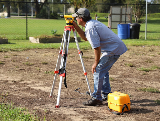
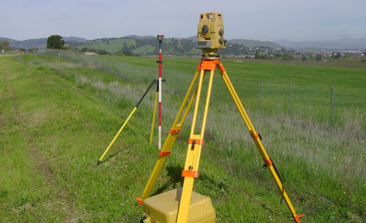
Expect a professional land surveyor to conduct thorough research on your property, including reviewing public records and previous surveys. They will use specialized equipment to measure distances and angles on your property, marking boundary lines and noting significant features.
Legal Considerations in a Land Survey
Legal considerations are at the heart of land surveying. Surveys must adhere to local, state, and federal laws, and the results have legal implications, especially regarding property boundaries and land transactions.
How a Land Survey Fits Into Your Land Improvement Plan
A land survey is a foundational element of any land improvement plan. It provides a legal and physical framework upon which all development and land management decisions are based.
Land clearing is the next step. It involves removing trees, brush, and other obstacles, providing a clean slate for precise surveying and future construction. This process not only facilitates easier access for surveyors but also lays the groundwork for any development or landscaping plans. For those embarking on land improvement projects, Texas Clearing’s land clearing services are crucial for preparing your property for accurate surveys and successful development.

Get Your Free Quote
Ready to start your land survey project? Contact Texas Clearing for a free quote. Our team of experienced professionals is ready to provide you with accurate and reliable land survey services.
FAQ
The main purpose of a land survey is to accurately measure and map a property, establishing legal boundaries and identifying key features.
The best type of land survey depends on your specific needs, whether it’s determining property lines, planning construction, or preparing for a real estate transaction.
You need a land survey when buying or selling property, resolving boundary disputes, or planning construction or development projects.
The cost of a land survey varies based on the type of survey, the size of the property, and the complexity of the work involved. Contact us for a tailored estimate.
A licensed land surveyor is crucial in conducting property surveys. They use techniques like plane surveying and distance measurements to determine property shapes and boundaries. The surveyor places physical markers, such as iron rods, to denote these boundaries. For legal purposes, the work of a professional surveyor is essential to create a legal property record, which is often required by title companies and real estate agents.
Legal standards play a significant role in land surveying. They ensure that the surveys conducted by licensed surveyors meet the required accuracy for legal purposes. This is particularly important for county assessors and county recorders who maintain real property records. Reliable titles, often facilitated by a title company, depend on accurate land survey records to reflect the true nature of a piece of land.
